Mendota Creek
Mendota, Illinois, United States
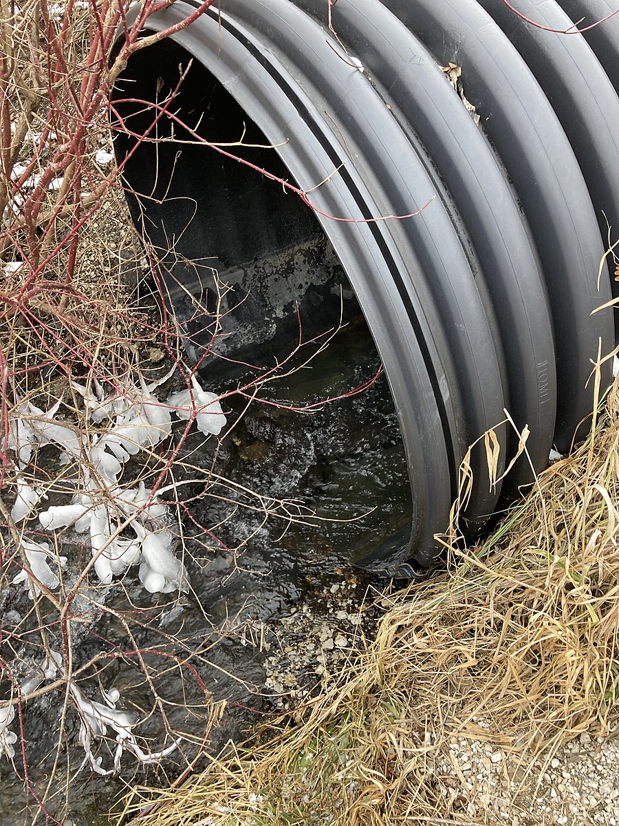
Walk on trail to culvert, access creek on right side of culvert. Access here tests stream coming off the farm field. Water is moving, but creek is shallow and narrow, except during flooding in spring. There is no danger here, except during flooding.

Location created by
Amy Brewer
- Group: National Great Rivers : Winter Chloride Watch
- Site ID: R0415501
- Lat: 41.5664115
- Lng: -89.1434312
- Waterbody Type: Creek
- Timezone: America/Chicago
Latest photos
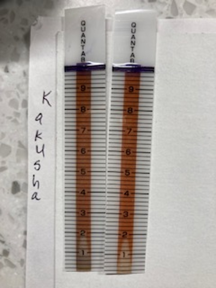
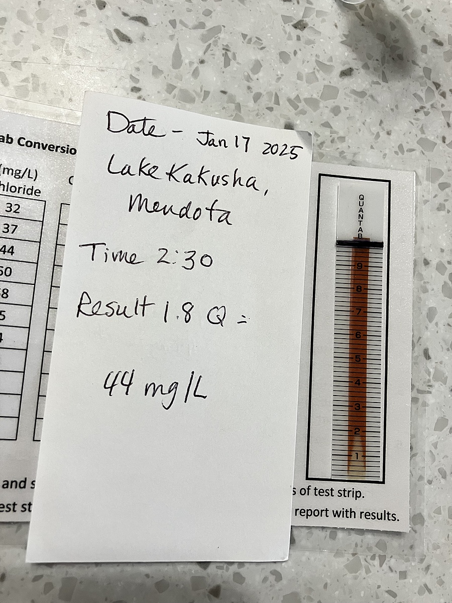
I did a double test and they didn't quite come out the same. I rinsed both vials, and sampled at the same spot at almost exactly the same time. Not sure why, but they read different. I took the lower of the tow.
This is the starting point for the creek that runs through town and feeds the Little Vermillion River. This sample was taken two days before a big winter storm. I will collect again after the storm to record any change in chloride from the salt the street department uses to help keep roads usable from the big storm's ice/snow
site # R0415501