You need to be registered to request to join groups.
Sign UpTawatinaw Watershed Working Group
Leaderboard

460 Points

240 Points

100 Points

90 Points

60 Points
About
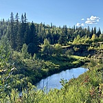
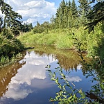
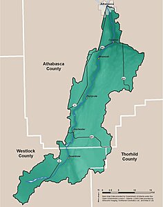
The Tawatinaw River watershed covers an area of approximately 746 km2 and is balanced by forests, wetlands, and agriculture. This group brings together landowners, community organizations, and nature lovers to meet, discuss, and participate in projects ocurring in the region. The Tawatinaw Watershed begins at Helliwell Lake before flowing north to meet the Athabasca River at the Town of Athabasca. We would like to extend our gratitude and acknowledge the Land Stewardship Centre's financial support that allowed us to obtain and begin this citizen science project in the Tawatinaw Watershed.
Water testing protocol
We are following the Water Rangers water testing protocol. We currently have 5 water testing kits and our goal is to have at least 3 sites regularly sampled in the upper, middle and lower reaches of the watershed. We encourage our citizen scientists to follow the recomended minimum sampling on the last weekend of every month. If their curiosity is peaked, during long periods of heat or after heavy rain are also great times for additional samples.

