pH (0-14)
What's this?
8.01
Muskrat River at Hwy 17 - Site ID - MKR-02 : Muskrat Lake Watershed
Ontario, Canada
Observed by
Cale Jackson
- Observed on: Sun, 16 Apr 2017 15:35:00 -0400
-
Associated with:
Protect Our Waters - Lat: 45.7355266
- Lng: -77.0000839
Observation report
See trends at this locationWater quality tests
Pending Quality Check from Water Rangers What's this?
Secchi depth m
What's this?
bottom visible
Hardness mg/L
What's this?
150.0
Alkalinity mg/L
What's this?
120.0
Water depth m
What's this?
0.5
Conductivity μS/cm
What's this?
282.0
Air temperature °C
What's this?
9.4
Water temperature °C
What's this?
7.6
Ice off
What's this?
Since: 2017-04-16
Latest photos
Notes
Heavy rain, 9.1 degrees centigrade
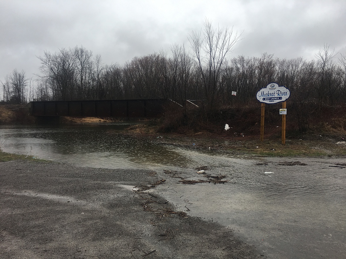
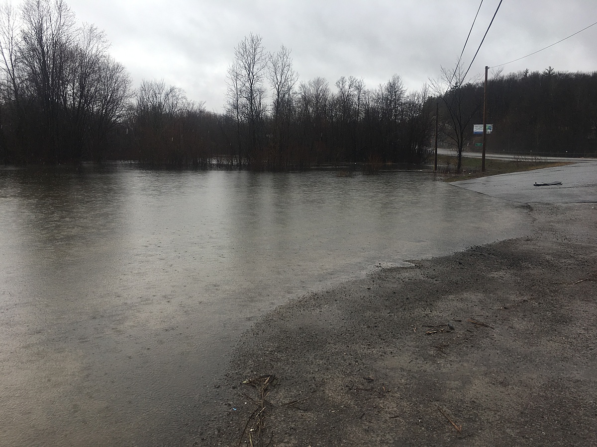
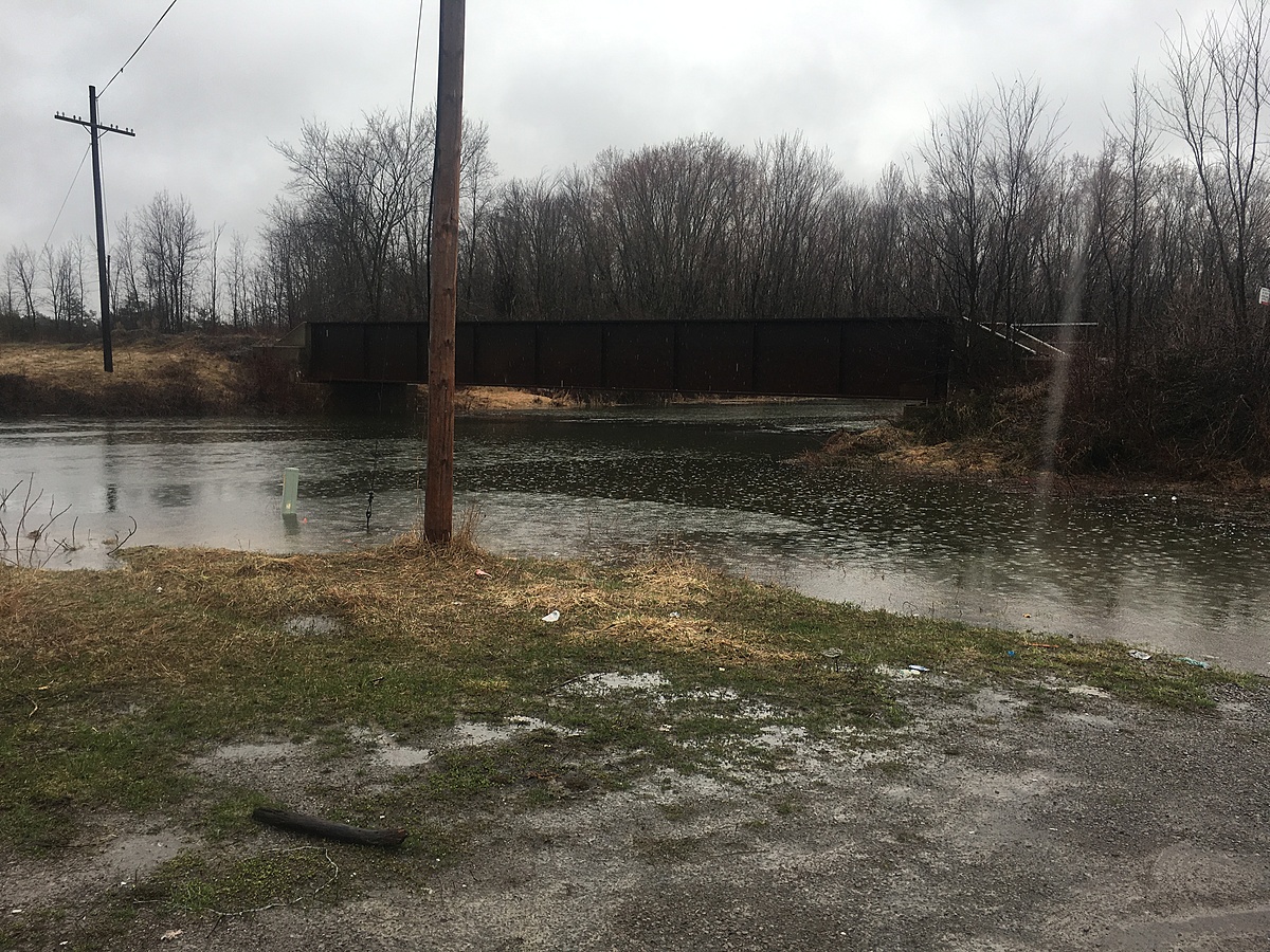
Muskrat River is high and fast. Lots of flooding along the riverbank. Debris floating past. Boat launch and parking lot are flooded.