Michipicoten River (MRM-WM-E) : Michipicoten River
Michipicoten, Ontario, Canada

Observed by
Ty Hourtovenko
- Observed on: Sun, 03 Nov 2024 12:25:00 +0000
-
Associated with:
Missanabie Cree First Nation : Dog Lake Head Waters Monitoring Program - Lat: 47.9222696
- Lng: -84.8045415
Observation report
See trends at this locationWater quality tests
Pending Quality Check from Water Rangers What's this?
pH (0-14)
What's this?
6.6
Dissolved oxygen mg/L
What's this?
10.0
Secchi depth m
What's this?
bottom visible
Chlorine ppm
What's this?
0.0
Hardness mg/L
What's this?
0.0
Alkalinity mg/L
What's this?
20.0
Water depth m
What's this?
0.25
Conductivity μS/cm
What's this?
69.0
Air temperature °C
What's this?
11.0
Water temperature °C
What's this?
8.3
Total dissolved solids ppm
What's this?
35.0
Weather
Current weather What's this?
Weather in previous 24 hours What's this?
Latest photos
Notes
Bald Eagle Sighting.
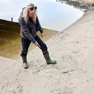
Various Salmon Carcasses along the sandy shores, indicating the eagle has been feeding well.
See pictures for salmon carcass size comparison.
5 Salmon carcasses total.
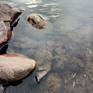
Algae specimen that has encapsulated some of the rock beneath the Hwy 17 Bridge cannot be identified. Uncertain whether the brown clotty sludge is algae or another species. To be further investigated at this site next visit and different seasonal intervals.


