Prairie Branch Creek
Jackson, Mississippi, United States
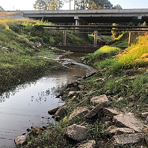
The Prairie Branch test site is on the left downstream bank below the Flowood Drive bridge. It is accessible from the parking lot of the First Pentecostal Church of Jackson parking lot, 2153 Flowood Drive. From the intersection of Tree Tops Boulevard and Flowood Drive (Hwy 468), turn right from Tree Tops to Flowood Blvd. and go 0.2 miles, cross the bridge over Prairie Branch, then immediately turn to the first right into the the church lot. Mr. John Chatom (601- 936-0101, 601-966-1200) is the pastor, who has given permission via Will McDearman for PRK volunteers to park in the church lot for testing. The creek also can be accessed from behind Q & M Motors, 2141 Flowood Drive (601-939-2290), a used car lot next to the church, by walking from the front lot to the back (Figure 2). Be sure to inform and contact the Q & M manager if parking in their lot and going to the rear of their property. From the church parking lot, descend the creek bank for testing. After flooding or heavy rain, the fine silty soil on the banks can be muddy, extremely slippery, or deep – and the creek may not be accessible.

- Group: Mississippi State University : Mississippi Water Stewards
- Lat: 32.3213562
- Lng: -90.1237035
- Waterbody Type: Creek
- Timezone: America/Chicago
Latest photos
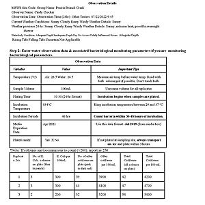
View all photosVery low flow and depth, weather very hot and dry, no rain past 2 weeks.
very low summer flow, very hot and dry last 2 weeks with daily highs ~99 - 102.
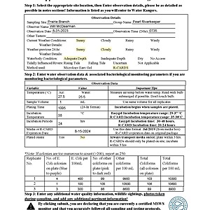
very low flow, hot and dry, no rain last 2 weeks.
very low flow, shallow, scummy on surface, muddy and turbid.
no flow due to backwater flooding from Pearl River, surface scummy
Creek flowing at typical low summer flow in absence of recent rain. Muddy and turbid.
Water level much lower at about normal summer flow following Pearl River backwater flood previous week at a river flood stage of 33.2'. Current Pearl River stage 19.5' at USGS Hwy 25 upstream gauge. No air or water temperature data due to thermometer malfunction.
Creek flooded from Pearl River flood backwater. Pearl River at 32.1 feet from USGS Hwy 25 gauge. Air and water temperature not available.
wet water line about 1 foot above current level from apparent rain the day before
low flow


