Wagg Creek west branch emerges - WAG-W-03 High Priority
North Vancouver, British Columbia, Canada
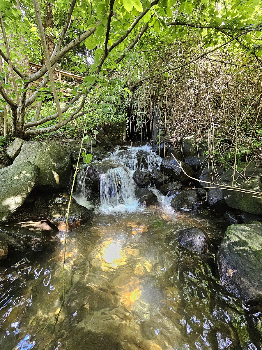
location of WAG-W-03 using zoom on web app. West of Chesterfield and south of 23rd St. the west branch of Wagg Creek emerges from a 1.3 x 1.3 poured concrete box culvert. This is where the creek first surfaces south of Highway #1. This is a high energy, high flow site. Field measured GPS coordinates in NAD83 are -123.0754710, 49.32972203 in Long and Lat, or UTM 494516E, 5,464,113N

Location created by
Paul Lhotka
- Site ID: WAG-W-03
- Lat: 49.3296111
- Lng: -123.0754995
- Waterbody Type: Unknown
- Timezone: America/Vancouver
Latest photos


Turb less than 14- brownish cast. Looks about 5NTU
YSI measurements taken simultaneously
6PPD-Q water sample collected
Simultaneous measurements done with YSI.
6PPD-Q sample collected.
No foam observed. High flows, water has grayish coloration.
Carolynne smelled a slight sewage-like odor.
Less than 14
Simultaneous measurements taken with YSI.
Water completely clear <14 NTU.
Chlorine 0
High energy flow, "first flush" rainfall event. Lower conductivity due to increased water volume. Foam and brownish cloudy water. Water sample collected from ~20m downstream of culvert opening.
water temps taken from conductivity meter. Visible scum and oil residue on water surface of plunge pool.
Water clarity is <14 NTU (water column clear - unable to enter "<" symbol ).
Period of rain over several days. Water appears clear 100% visibility.
Slight smell of gray water. Deep shade. Water running well.