
Mundy Lake
Coquitlam, British Columbia, Canada
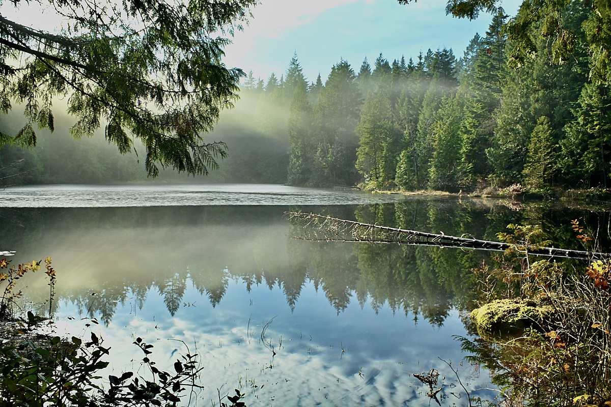
The test area is the south-west side of Mundy Lake; approximately 50 m north of the Mundy Creek outflow.
There is a very slow, visible flow south , it has natural debris on the surface, there is no algae, tea water colour, clear clarity, no odour. Vegetation such as moss, lady fern, cedar trees, bushes such as huckleberry and salal are right at the edge of the water. Western pond lilies are present on the surface at the lake, but not at the testing site. Submerged tree fall is present in the lake and near the testing site. The ground adjacent to the lake is boggy. Bears can be present in the park.

Location created by
C E Thomson
- Group: Burke Mountain Naturalists
- Site ID: 49.25759 N, 122.82923 W
- Lat: 49.2573442
- Lng: -122.829423
- Waterbody Type: Lake
- Timezone: America/Vancouver
Latest photos
lots of surface mat of usual plant/algae matter
pH obtained using test strips, pH may be out of test strip range
black capped chickadee
red breasted nuthatch
song sparrow
golden crowned kinglet
This is the second pH reading obtained using the water rangers pH meter.
Bullfrog
insect hatch
Pacific sloped flycatcher
Pine siskin
Anna's hummingbird
pH recorded with pH meter (19.9 C)
lily pads observed on surface
1 bull frog
1 American robin, Swainson's thrush, warbling vireo, Red Cross bill (identified with Merlin app)
1 Pacific sloped fly catcher, 1 hermit thrush, 1 Western tanager
Song sparrow heard
Some flooding of trail
High water level, some trail flooding
Attempted to use new calibrated pH meter, but question the result of a pH value of 8.7 obtained
pollen observed on surface of lake
2 pairs of mallards observed
pine siskin, pacific wren, purple finch, house finch, black capped chickadee heard and confirmed by Merlin app
water level is high, some flooding on trails around the lake
Unable to reach usual location due to flooding of trail; utilized closest location to original location that was accessible: coordinates of today's location:49.25786 N; 122.82774 W
Water Depth not able to be recorded....please note when looking at data trends for water depth (no depth data recorded on Jan. 28/24)
1 common raven observed
1 fox sparrow observed
Water level noticeably higher than last month
Less human activity on this chilly morning
Hairy woodpecker, Stellar Jay, Song Sparrow, Spotted Towhee observed