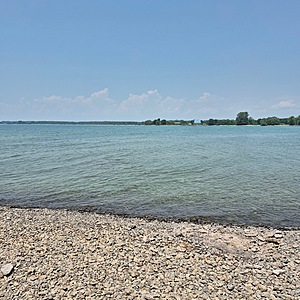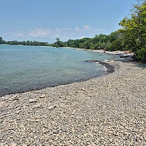
Lake Ontario at Soup Harbour
Ontario, Canada
Test spot at Soup Harbour just south of previous site, with a picnic table and clearing along the shore with easy access off trails. Enter at 2nd trail on the right off the main road once you pass the Park entrance sign. It’s best to walk in as it’s very rough to try taking a car in there. Park along the road instead.

- Group: County Sustainability Group
- Lat: 43.8523242
- Lng: -77.1610379
- Waterbody Type: Lake
- Timezone: America/Toronto
Latest photos
View all photosHazy sky from the smoke drifted in to the province from the Alberta forest fires. No rain in past 24 hrs. The area where we have been testing for the past years is now privately owned so is not accessible anymore. We’ve moved our test spot down the shore here a bit further south now to test. Results will be very comparable at the new site to this old one so data still relevant. Water colour is 2 contrasting shades of blue/green between that closer to shore and further out. Seagulls and loons and songbirds seen. Winds creating choppy waves with whitecaps and shoreline more underwater than some other times.


